Mt Kinabalu is the highest mountain in South East Asia at 4095 metres (13435 ft). Located at Sabah, in the island of Borneo, Mt K is essentially a huge granite dome (batholith) that was pushed up from the earth’s crust as molten rock millions of years ago. In geological terms, it is a very young mountain as the granite cooled and hardened only about 10 million years ago.

看起来不像自己拍的照片吧?超酷~~!
The Mt KK information (getting there, reservation, preparation & etc...) can be found here http://www.mount-kinabalu-borneo.com/
登山的前言与后语
最幸运的:
前往最高峰的天气, 很不错哩!之前一天, 或之后一天都下着倾盆大雨。 虽然上下山都湿透了, 但总算比起那些前一天的登山者, 花了金钱, 时间与力气, 就只差8公里而已就被逼下山好多了。
最佳精神奖:
之前都没什么时间运动, 导致上山下山都觉得好累好酸哩!差劲的我好几次还想过放弃呢,幸亏, 我的意志力战胜了我那歪念头, 让我勇往直前, 最后还好能登山成功!而且还是第一名呢!所以呢, 这奖是不是非我莫属呀?(虽然下山后的我,双脚发抖发软, 而且行动不便呢, 也都没埋怨!)
最希望的:
最希望的:
其实要上神山呢,可以有着不同的路线,用着不同的方法, 当然就会有着不同的风景, 也有不同的享受喔!所以, 我希望下次能有这样的机会,试着享受这些非一般的过程。。。
最后的感想:
人生好比登山健行, 参与的人有些高高大大, 有些却体格矮小; 高大的人不一定走的快, 矮小的人也不一定走的慢; 有些人走的快,也有些人却走得慢; 走得慢的, 时间上可能会出问题, 例如错过了午饭时间, 少吃了一餐; 也可能天黑了赶不上行程, 或错过了日出。 快的也不见得比慢的好, 至少慢的人懂得去欣赏和享受。 欣赏四周的环境与风景,然后慢慢的享受当中的过程。 所以, 人生是没有对与错, 只在乎你要的是什么?调好适合自己的脚步, 踏上自己的梦想之路吧!你想要一个怎样的人生,就怎么去选择自己要走的路啰。。。
Timpohon Gate (starting point @ Kinabalu Park HQ) --> Penar Laban, 200m from Laban Rata (overnight) --> Summit --> Timpohon Gate
Climbing Preparation :
1. Pls prepare at least 2 pair of socks bcz quite wet there. I was wearing the wet sock due to the raining day with the wet shoe by covering an extra layer (plastic bag) between the sock and shoe. So weird look n uncomfortable :(
2. Pls prepare more energy bar or any other food that is easily taken out during the hike. Don't forget to eat somthing before start your walk in the midnight from Laban Rata bcz many people are feeling not well after 30 mins of their walk.
3. Don't forget your headlight & battery and torch light in case the headlight not function properly.
4. I was in delay reaction and crawling and howling in pain each time when try to move after the climbing and the following day. Emm, seems like an old woman walk in slow motion... haha.... So pls bring muscle relief cream to apply after the mt kk climb.
5. Pls have your early and a good sleep because around 2am you got to wake up and start your walk @ 2.30am++..... A good sleep is very important ya...
Kinabalu Park HQ is the usual place where you would start your climbing journey. It is the place for registration, get your guide and porter (if necessary) and also the place for you to stay for the first night. Sabah Park, the Kinabalu Park authorities will be responsible for all the things that is concerning the climbing.
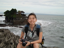
After months of preparation of research and physical training, we finally arrived in Kota Kinabalu (KK) by the free airasia ticket. KK is the nearest town and the gateway to Kinabalu National Park where Mt K is located. We spent the 1st day exploring KK town and stayed at Cabin Backpacker Hostel in KK, which costs RM25 for a dorm bed. The hostel was clean, friendly and is within walking distance from the town but I was itchy and can't sleep well due to mosquito bite and noisy sound from town.
After checking-in, we walked to town to enquire about our bus trip to the National Park the next morning. We wandered around town, taking lots of photos. KK is a small town and you can take a lot in just by walking. We find the locals very friendly and helpful.
Next morning, the tour agent pick us from KK town to Kinabalu National Park after a quick breakfast @ 5am. It takes just about 2 hours to reach Park HQ, but already more than 1500m above KK. Upon arrival at Park HQ, we registered for our climb for the following morning and arranged for a guide and porter. I prayed hard to have a good day to climb. Unfortunately, we had no chance to walk around the Park HQ due to heavy rain. After 2 hours waiting there, we only started the walk because the rain was getting smaller.

There are toilets and water refills at all the shelters.
Most climbers start their climb from Timpohon Gate. The trail started nice and easy. There are 6 shelters along the way up to Laban Rata, the half-way overnight stop. At 2nd shelter, we could see lots of pitcher plants in the surroundings.

One of the view during the walk to Laban Rata.
The forest is now thicker and mossy, and tree ferns are abundant in the area. We took our lunch box here which provided by the tour guide. We pressed on and after 40 minutes of climbing, we arrived at Pondok Villosa. The vegetation now has changed dramatically, with the forest shorter and more open. Another 45 minutes of steady climbing and following by another 40 mins of climbing after the last shelter, we finally rounded a corner and saw the Laban Rata sign up ahead. I was slightly surprised as I thought we still had a long way to go. Yeah! The first stage is completed. It was only 2:30pm, not bad as I thought!

Laban Rata view.

Sea-cloud view from Laban Rata.
You do not have to worry about your meals here as there are restaurants in Kinabalu Park and Laban Rata. However, the price is a bit expensive compared to normal meals anywhere else. So, most of the climbers bring along their own food. Instant mee, instant coffee, tuna, bread and chocolate is the usual things that they bring.

Everyone is tired and rest in the canteen @ Laban Rata.

The only activities in Laban Rata: play Sepak Takraw.
We rested at Laban Rata Resthouse (which is the only accommodation at Laban Rata with facilities & a restaurant) but we had to go to our room in Panar Laban after shower here, which is 200m far from Laban Rata Resthouse because there is no heater bathroom in Panar Laban.
In the midnight, I felt stomachache but nobody want to acompany me to the external toilet which is quite dark and cold weather outside come with the natural/animal sound. So bad that i still got to make the "big business" then only continue my sleep but I felt like I'd just closed my eyes just for few mins, there was followed by an alarm alert. We got up, put on our warm clothes & gear and had a quick breakfast before we headed out for the summit climb (I force myself to eat but actually I had no appetise to eat at all... so sleepy....). It was dark and everyone walked single-filed. There were some very dangerous areas at this stage although we didn’t realise until we descended later. It was pitch black during our ascent and we just followed a rope to guide us up the naked granite rock to the summit. This is the time to show how important of your headlight to get the bright road for yourself. The rope and the compulsory guide make this now extremely unlikely even in the thickest mist. The air was decidedly thin then as we were so high up in altitude and it got harder and harder to breathe especially when you are so tired on non-stop hiking.
After a while we past Sayat Sayat hut, which was the last check point and highest mountain hut (3810m /12,500f) before the summit. Again, we all have to register at the check point. This is the last chance for anyone to turn back if they are not, or could not, go further, or if the weather is bad. For my trip, it was really so lucky day because it was a sunny day for this summit walk and only heavy rain on the day before and the day after (I met some unlucky hikers are turning back during my ascending hike). We passed the 8km mark shortly. From here, the bare granite slabs stretch endlessly ahead all the way up to Low’s Peak (Mt KK). Consistenly, we climbed on until finally we arrived at Low’s Peak. I didn't realise that I passed over all the climbers along my way up to the summit and I was the first person to reach to the summit. Yeah !! Well done, girl....

Finally I reach to the summit @ 5am. Unbelievable that I was the first person to reach to the summit on that day.

It is the place where you could see breathtaking sunrise from above the clouds, 13,435 feet (4095 meters) above sea level. Only can be view if you reach early like me :P
It was freezing cold at the top and we waited for more than 1 hours there. The sun was just coming over the horizon then and we sat down to enjoy the sunrise and absorb the atmosphere at the highest point in South East Asia. From the top, the view of the surrounding peaks is magnificent. After the obligatory photo at the summit plaque, we headed down.

My tour guide and I...

I started to going down after sunrise.

The mt kk view is getting brighter when I headed down.
This has been a truly unique climb from tropical luxuriance right through to montane oak forest to the rocky sub-alpine summit plateau. We descended to Laban Rata, had a short rest, checked out and continued the descent down to Park HQ. We arrived at Park HQ around 1pm and were promptly handed our coloured Certificate for having reached to the summit.
Note :
Mount Kinabalu is extremely climber-friendly and compared to other lower mountains around the world, it is an ideal first mountain for novice mountain climbers to conquer.
nice place to visit, thank
ReplyDeleteWhich month you are there? sky is clear. U reach the peak at 5am, don't feel cold and strong wind??
ReplyDeleteIn case you go again, shall try mesilau track up and down timpohon...
great thoughts about life!
ReplyDelete